
A Supreme Court-appointed committee has asked for six more months to complete a scientific definition of the Aravalli hills and ranges, arguing that the ecosystem cannot be captured through a single elevation or terrain rule.
The High-Powered Committee submitted its compliance report on August 31, 2026 and requested an extension until February 28, 2027.
Why the Aravalli hills definition matters
A legal and scientific definition can determine which land receives environmental protection and how mining, construction and other activities are regulated across parts of Rajasthan, Haryana, Delhi and Gujarat.
An overly narrow test could leave ecologically connected areas outside protection. An overly broad or poorly validated map could also affect settlements, livelihoods and land regulation without sufficient evidence.
An ecosystem-based framework
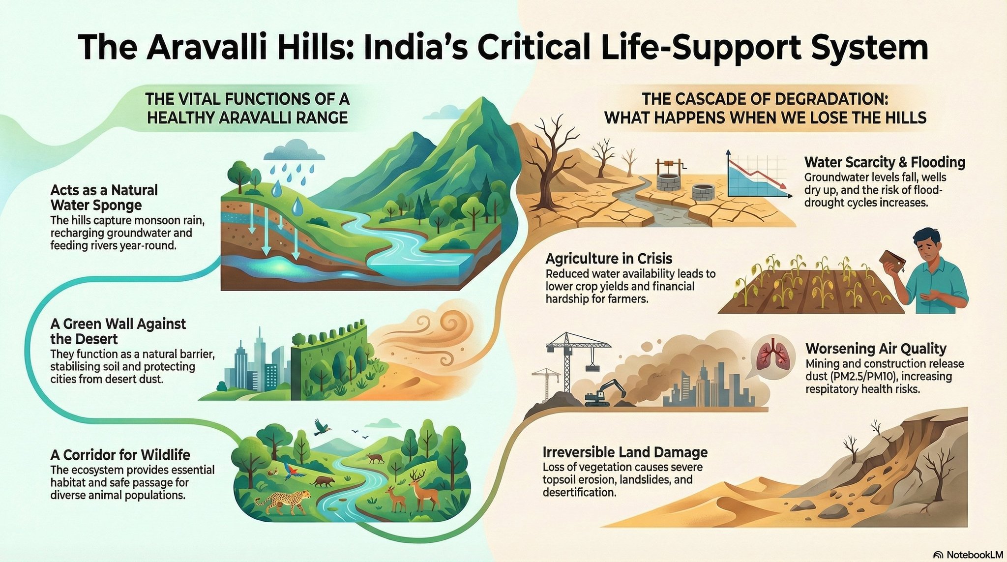
The committee proposes treating the Aravallis as an interconnected landscape involving geology, forests, biodiversity, water systems, ecological corridors and human livelihoods.
It said additional time is needed for geospatial analysis, sensitivity testing, expert examination, field validation, stakeholder input and synthesis. The panel cautioned against releasing area estimates before its methodology and data are validated.
Background to the committee
The Supreme Court constituted the five-member panel in June 2026 after identifying unresolved questions in earlier attempts to define the range. The Environment Ministry later invited public and stakeholder submissions.
A previous height-based approach had drawn criticism because the Forest Survey of India warned that a 100-metre threshold could exclude large parts of the landscape. The present panel is trying to avoid relying on one physical yardstick.
The extension is not yet the final definition
The committee’s request does not itself change protected boundaries. The Supreme Court must consider the extension, and the panel must ultimately submit a report that can be examined by the court and interested parties.
The request follows an earlier court refusal to extend the deadline for stakeholder submissions. That procedural decision is separate from the panel’s later request for more time to complete technical work.
What to watch
The final report should disclose its data sources, mapping method, treatment of fragmented habitats and process for resolving conflicting state records. Public access to maps and methodology would support scrutiny.
The court will also need to balance conservation with legal certainty for residents and governments. Any definition could have lasting implications for mining permissions, urban expansion, groundwater recharge and wildlife movement.
For now, the key development is a request for additional time and a stated commitment to an ecosystem-wide method—not a final redrawing of the Aravalli boundary.

